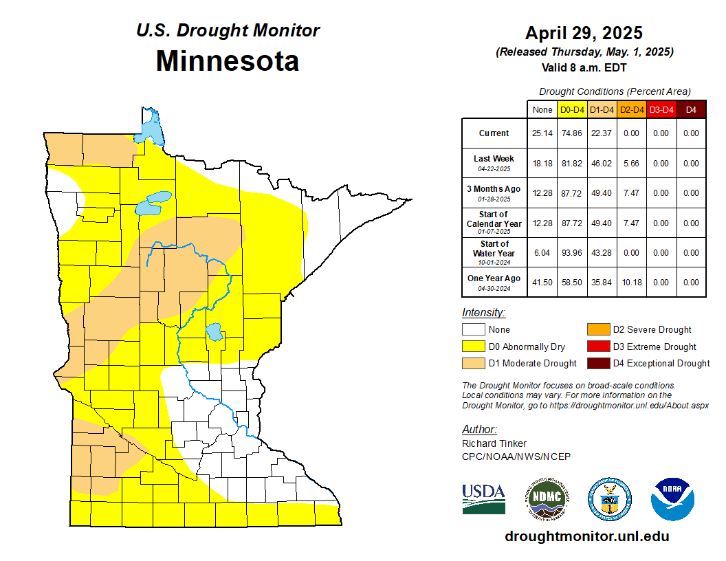
Current Drought in Minnesota
(Click map for more info)

US Drought Monitor
- US Drought Monitor- National Map (National Drought Mitigation Center)
Frequently Updated Precipitation Data
- Radar-based Precipitation Estimates for Previous Seven Days (National Weather Service)
- 90 Days (National Weather Service)
- 90 Days, Percent-of-Normal (National Weather Service)
- Weekly Precipitation Maps (DNR State Climatology Office, prepared Tuesdays by 2:00 PM)
Sector Information Resources
- Stream Flow
- Daily Stream Discharge Map (U.S. Geological Survey)
- Weekly Stream Discharge Map (MN DNR - Ecological and Water Resources)
- Lake Levels
- Lake Minnetonka Water Level (Minnehaha Creek Watershed District)
- White Bear Lake Water Level (MN DNR)
- Lake Superior Water Level (Great Lakes Environmental Research Laboratory)
- Lake of the Woods and Rainy Lake Water Levels (Lake of the Woods Control Board)
- Ground Water Level Data
- Real-Time Ground Water Level Network (U.S. Geological Survey)
- Agriculture
- Crop Progress/Conditions and Soil Moisture (MN Agricultural Statistics Service)
- Soil Moisture Estimates (National Weather Service - Climate Prediction Center)
- Vegetation Drought Response Index for Minnesota (National Drought Mitigation Center)
- Wildfire Danger
- Wildfire Danger Map (MN DNR - Division of Forestry)
- Forest Health
- Forest Insect and Disease Newsletter (MN DNR - Division of Forestry)
Additional Drought Information
- DNR Drought Information Resources
- Drought Summary from National Weather Service Forecast Office - Grand Forks
- Drought Summary from National Weather Service Forecast Office - La Crosse
- Drought Summary from National Weather Service Forecast Office - Sioux Falls
- Drought Summary from National Weather Service Forecast Office - Chanhassen
- Precipitation needed for drought recovery from NOAA/NCEI
For more information contact [email protected]

