

NPC Page Template
FDs37 - Southern Dry-Mesic Oak (Maple) Woodland
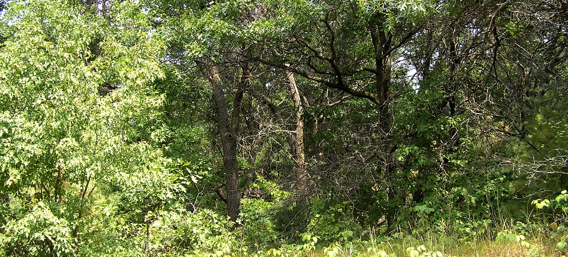
Vegetation Structure & Composition
Description is based on summary of vegetation data from 13 plots (relevés).
- Ground-layer cover is patchy to continuous (25-100%). Pointed-leaved tick trefoil (Desmodium glutinosum), Clayton’s sweet cicely (Osmorhiza claytonii), Hog peanut (Amphicarpaea bracteata), Canada mayflower (Maianthemum canadense), and wild geranium (Geranium maculatum) are commonly present. Pennsylvania sedge (Carex pensylvanica) is the most abundant graminoid. Dewey’s sedge (Carex deweyana) and starry sedge (Carex rosea) may also be present.
- Shrub-layer cover is patchy to continuous (25-100%). Common species include black cherry, red maple, chokecherry (Prunus virginiana), American hazel (Corylus americana), gray dogwood (Cornus racemosa), prickly ash (Zanthoxylum americanum), Virginia creeper (Parthenocissus spp.), and poison ivy (Toxicodendron rydbergii).
- Subcanopy cover is patchy to interrupted (25-75%). The most common species are black cherry, red maple, and bur oak.
- Canopy cover is usually interrupted to continuous (50-100%). Bur oak and northern pin oak are the most common species. Northern red oak, white oak, and red maple are occasionally present. Older trees are often open grown, indicating previously more open conditions on the site.
Landscape Setting and Soils
- Glacial lake plains — Common. Present on undulating sand flats that were deposited in the shallow waters of Glacial Lake Grantsburg. Parent material is stoneless, well-sorted fine sand. It was initially calcareous, but soils are now leached of carbonates. Subsoil horizons capable of perching snowmelt are lacking, but general fine-sand texture and occasional bands of silt and gravel can help to retain some soil moisture. Densely cemented layers of sand that may reflect past positions of the water table occur at depth and can help hold water for deeply rooted plants. Soils are excessively drained and the soil-moisture regime is moderately dry. (Anoka Sand Plain in MIM)
- Stagnation moraines — Occasional. Present on hummocky moraines, often adjacent to fire-prone outwash plains and tunnel valleys that were occupied in the past by brushland or prairie. Parent material is a discontinuous cap of partially sorted gravelly sand over a base of denser till and is often complexly stratified. Parent material can be calcareous or noncalcareous; when calcareous, soils are leached of free carbonates to at least 30in (75cm). Although some clays have accumulated in the subsoil, clays are insufficient to perch snowmelt and rainfall. The complex stratification allows these sites to retain some rainfall, and water is available to deeply rooted plants just above the dense till. Where the sandy cap is thick, the soils are excessively drained, and the soil moisture regime is moderately dry. Where the cap is thinner, the soils are well drained, and the soil-moisture regime is fresh. (St. Paul-Baldwin Plains and Hardwood Hills in MIM, and locally in Pine Moraines and Outwash plains in MDL)
- River bluffs (Minnesota River valley) — Common. Present on generally steep (20-50%) south- or west-facing slopes on the north side of the Minnesota River valley and other major stream systems. Soils are developed on eroded calcareous till or cut-faces of gravelly terraces well above modern alluvium in valleys. Free carbonates are present at or close to the surface and topsoil layers are thin because of surface erosion. Soils are somewhat excessively to excessively drained. Soil moisture regime is dry to moderately fresh. (Minnesota River Prairie in CGP)